These are the archived notes for the OpenAtlas poster implemented by our graphic designer Jan (#2015).
There should be 3 to 5 sections about important core features. We first collect these (feel free to add) and weight, refine content, ... them later.
Newest strategy would be to use attributes, see below
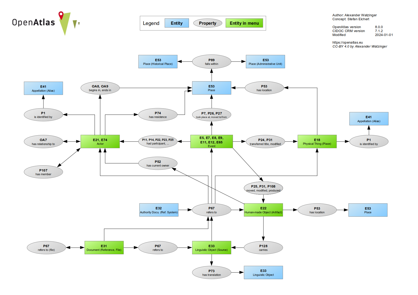
The data model specifies the structure in which the information is stored within the database.
The use of an ontology, for example, allows the data to be combined more easily with information
from other projects and is consistent with the FAIR principles. The OpenAtlas Model is based on
the international standard of CIDOC CRM, an ontology widely used within the field of humanities.
Places with known location can be entered into an interactive map based on Leaflet, which features different view layers,
allows for zooming, fullscreen mode, clustering, searching and much more. PostGIS is used for creating and manipulating spatial data.
Therefore, it is possible to enter location as needed as multiple points, lines, areas and shapes.
Person and Groups with their biographical information can be connected with different properties and in hierarchically order, forming a complex network of actors.
Actors can act through different kinds of events (e.g. Activity, Production, Acquisition, ...) forming their life story and how they are connected to other Actors and also Places and Artifacts.