Bug #1069
closed
Overlay maps: interchanged easting and northing
Added by Alexander Watzinger over 6 years ago.
Updated about 3 years ago.
Description
When implementing #1003 I got confused with easting and northing values.
When checking Stará Kouřim (https://thanados.openatlas.eu/place/view/111285) of the Thanados project my doubts were confirmed that at some point we are using them wrong. I attached 2 screenshots:
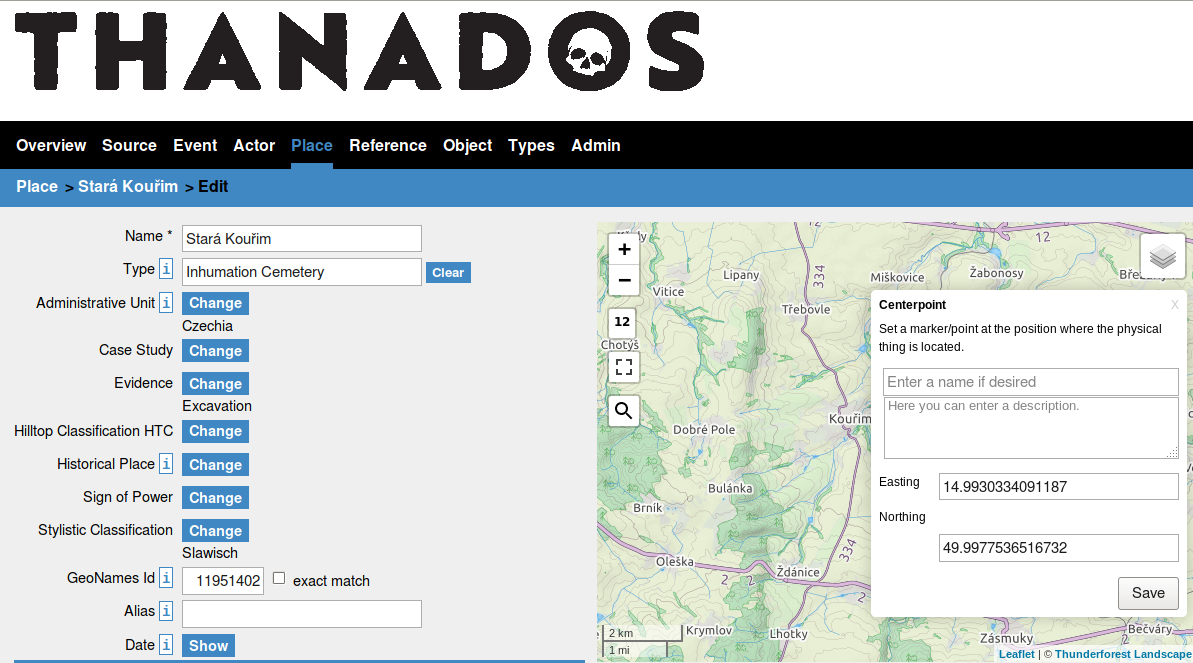
- Screenshot1 shows the form for the centerpoint
- Screenshot2 shows the form of the overlay image
Although I thought we double checked this at the time of implementation you can clearly see that easting/northing values are switched in the forms.
Please for clarification which one is the right one.
Also, to avoid confusion in the future some documentation in (or linked in) Form_field_map about easting/northing and e.g. how to deal with it if data is only available in latitude and longitude would be nice. The white paper linked there seems outdated and missing that kind of information.
Files
In the map overlay form the labels for northing and easting should be switched. I guess then it should be good. The centerpoint form is correct.
- Subject changed from Switched easting and northing values to Overlay maps: interchanged easting and northing
- Status changed from Assigned to Closed
- Assignee changed from Stefan Eichert to Alexander Watzinger
- Target version changed from 187 to 3.20.1
Thank you very much for the quick reply. It's fixed in 3.20.1, will be deployed at Thanados at Tuesday with no further action needed there.
- Status changed from Closed to New
- Target version changed from 3.20.1 to 4.0.0
On insert coordinates are labelled different than on edit
- Status changed from New to Assigned
- Assignee changed from Alexander Watzinger to Stefan Eichert
I now fixed it (again)
@ Stefan: the fix is already implemented at the Thanados version online. Please test insert and upate and if the easting/northing values now work as expected. If they do please close this ticket. Otherwise add a note and re-assign to me.
Thanks for reporting.
- Status changed from Assigned to Closed
- Estimated time set to 4.00 h
- Target version changed from 4.0.0 to 3.20.1
Also available in: Atom
PDF

 Updated by
  Updated by
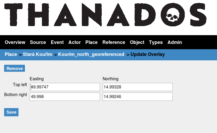